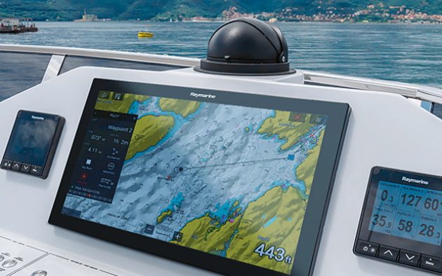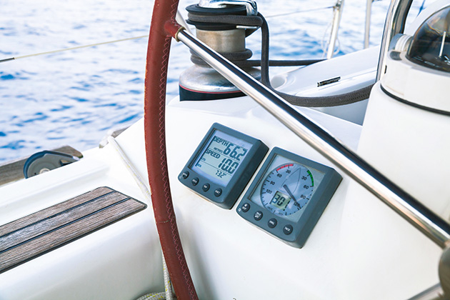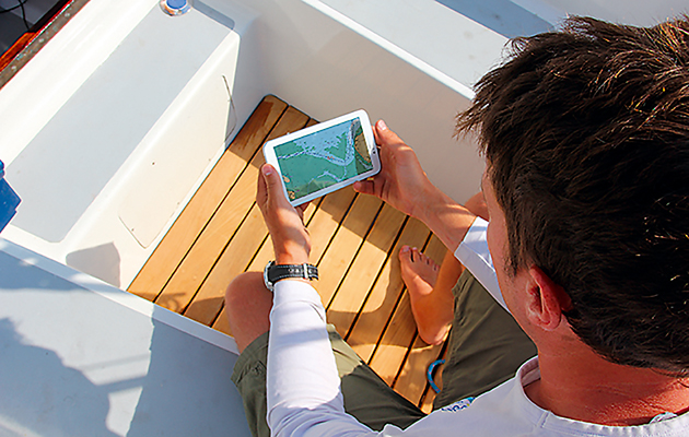
Allowing your electronic charts and other software to become out of date is dangerous, but updating can be something of a minefield. Toby Heppell looks at the options...
All the time we rely more and more upon our electronic charts and various other electronics onboard our boats, but they are only as accurate as their source data.
Not only is it good practice to ensure that the source data is current and accurate, ensuring our technology is kept updated can unlock any number of upgrades not included in the software installed at time of purchase.
Rocks might not move, but areas are re-surveyed all the time – and sandbanks and mudbanks certainly do move, not to mention new buoyage and wrecks, which appear all around our coasts – and we need to take advantage of any updates.
Updating paper charts is a simple matter of consulting the updates given in a relevant Notice to Mariners and transferring these via a trusty purple pen to the chart.
That’s all very well, but few people go to sea these days without electronic charts on board.
There’s even more need to update electronic charts than paper charts, especially as chart plotters display your position to a few metres on the chart and people sneak ever closer to obstructions, believing their charts and position to be accurate to the nearest centimetre.
If anything, the accuracy of electronic charting is both its key draw and drawback.
Digital charts are available in a variety of formats and with varying levels of complexity and price.
Each company offers a range of update products. You can just buy a new chart each time, but this can work out to be extremely expensive, so it’s worth putting in some time to research the options open to you.
Chart plotters
There are three main providers of charts – Garmin (Garmin BlueChart) Jeppesen (C-Map) and Navionics (now falling under the Garmin brand).
In addition Raymarine have recently launched their Lighthouse range of charts, which are free with some of their products but they are currently available only for North and South America and Australia.
Most of these companies offer their charts on memory cards for plotters and each sell their own iPad and Android tablet apps, which are much cheaper.
Navionics

Navionics was the first company to offer daily chart updates.
First, identify the type of Navionics charts and the type of memory card you are using: these are likely to be either SD cards, micro-SD cards or CompactFlash (CF) cards – though the latter are now being phased out.
You then order an update card online, which you plug into a card reader and onto which you can download an update from the Navionics server.
Your existing card verifies that you are upgrading an older chart and can then be used as a backup.
The fee charged for the update allows you to transfer your chart to a new area, or change media, for a new plotter.
Freshest data
Navionics offer 12 months’ free updates with every Navionics+, or Platinum+ chart chip.
This allows daily updates similar to those in the official Notices to Mariners, as well as Navionics’ SonarCharts (which use sonar logs from boats which submit their logs) and Community Edits (crowd-sourced data).
After this 12-month period has passed, your update options are as follows:
- Navionics+ – New chart £149.99- £229.99. Navionics+ gives you standard charting plus SonarCharts and Community edits. Updating is as Gold charts.
- Navionics Platinum+ – Newchart £229.99 (XL Europe) £339.99 (XL3 Europe). These charts also feature 3D and satellite overlay, panoramic port pictures, dynamic tides and currents. Once the 12-month Freshest Data update period is over, you can exchange your chart for a new chart card for half price – this gives a further one year’s worth of updates after you have registered the card. Cost is £99.99 for XL areas, or £149.99 for XL3 areas.

Plotter sync
Many of the newer plotters from various brands with Navionics charts can now be updated straight from a tablet computer via the plotter’s built-in WiFi.
You’ll need Navionics+ or Platinum+ and a Navionics Boating app on your phone or tablet. You can then opt to sync chart updates and upload any sonar logs to Navionics’ servers.
Garmin BlueChart
Garmin still have their own proprietary cartography offering (despite acquiring Navionics) for their range of plotters and offer a range of options for their charts.
Their two-level offering is similar to Navionics with a two-tier offering.
Not only this but the BlueChart G3 (the latest from Garmin) now incorporates some of the Navionics detailing and features.
Certainly there was a fair amount of difference between the old Bluechart G2 and the Navionics offering but now those differences are much smaller.
It’s worth noting that on initial purchase you can update the SD card or preloaded charts to their latest version for free – for the same (or equivalent) region as the original charts.
You can do this yourself by downloading a web browser plug-in on your PC and either preparing a microSD/SD card by inserting it into your plotter (assuming it has charts loaded) and then inserting it into a card reader on your computer, or just plugging a preloaded chart card into your PC, whereupon the browser will show you your update options.
Updating preloaded maps
If your chart plotter came preloaded with BlueChart G3 charts, you can update them online or visit a Garmin dealer to buy the update on a card. Update cards are available for selected GPSMAP and echoMAP ranges, and these generally cost around 50% of the cost of the equivalent new charts.
C-Map
For C-Map cards, you can identify your chart by the label on the cartridge and note the serial number, which shows the chart’s age. You can then enter it on the C-Map website.
With every update the chart’s version number increases by one. The official position is that a chart is out of date when it is two versions old. If you wish to update your charts, you can either update or upgrade:
Updating allows you to bring one of their chart chips up to date within the same price class or technology. Updating costs roughly half the price of a new chart and your local dealer can reprogram your card.
Upgrading means acquiring a higher price class or technology and is cheaper than purchasing a new chart, costing £139.99 for the Wide area chip. Again, you’ll need to visit a local dealer so they can reprogram your card.

Phone and tablet apps
Updating the cartography in navigation apps varies between app developers. Android and Apple apps offer the same cartography as plotters but at a much lower price, but it can be difficult to find out how often and how to update the cartography – often ‘updates’ only update the software, not the cartography.
Most of the chart / navigation apps offer connectivity to modern chart plotters allowing you to pass waypoint information or updates from one to the other.
It can also be useful in providing a second navigation repeater screen.
Navionics currently offer a short free period of access to Navionics+ as part of the app download, which gives you access to their daily ‘freshest data’ chart updates for two weeks.
After this you’ll need to pay for a subscription, which costs £34.99 for the UK, Ireland and Holland.
Other apps vary in price. C-Map also gives a free initial subscription period and costs £33.99 per year thereafter.
There many other options on the market, though perennial favourites in recent years have been SeaNav and Imray’s chart app, Navigator.
SeaNav offers UK and Ireland charts for an annual £19.99 subscription while Imray’s offering is at £34.99 per year, though obviously the later is underpinned by a big name in marine charting.
PC navigation software
Increasingly the line between PC Navigation software and tablet or smartphone apps is disappearing.
Where once you may have been looking at very different programmes in one or the other, now most are the same from platform to platform.
For coastal cruisers the days of the Phillips Toughbook or similarly marinised PC onboard for navigation purposes are long gone.
The easiest to update tend to be tablet nav apps which, with the tablet’s own data connection, make the process very simple.
Otherwise, keeping your chart plotter’s digital charts up to date can be an expensive business, which goes some way to explaining the continued roaring trade in out-of-date chips on eBay.
Navionics’ Freshest Data solution, with 12 months’ free updates followed by a subscription, offers the most frequent updates, and their Plotter Sync, which allows you to use your tablet to update Raymarine plotters, has been something of a boon.
Similarly, C-Map’s Club subscription offers savings if you have extensive chart coverage and want annual updates. Garmin offers updates for 30-50% off the cost a new card, with upgrades also available at 25% off.
The companies have to pay for their R&D and the cost of licensing the charts from various national authorities – but despite the accuracy offered by digital charting, the costs involved may mean that the boating public could be sailing around with charts more out of date than the paper charts we used to use!
More than just charts
Of course charts are one area that we must keep up to date – and for many of us the most obvious and key thing to update regularly.
But with increasing amounts of tech onboard we must now try and bear in mind that many items have software that will need updating.
For the most part, as with chart updates, this needs to be done via an SD card or microSD card, downloaded at home and then installed into the equipment onboard.
Usually you would be well advised to update your software whenever a new update becomes available. But some caution should also be exercised.
It’s good practice to look at the update information to see what features are being added (and in some circumstances taken away).
Obviously any security upgrades should be installed as soon as possible in order to make sure your kit continues to function correctly and safely – the same is true of bug fixes.
If the update is a major one and may actually change the parameters of how your kit works, it might well be worth having a bit of a think.
Theoretically an old piece of equipment that does not have the necessary power to run new software will not be included in the update list, but some older kit might be able to just about run new software at which point you may conclude that the risk is not worth the reward.
As a good rule of thumb, if your electronics have been purchased in the last three years, you can reasonably expect them to run anything that comes out.
More than five years and it would be worth thinking about whether a firmware update is really the best idea.
If you are attempting to update something you should always do so with two SD cards, one on which to clone the equipment as it currently is, and one on which to put the new software.
Often, if it is something like an MFD or other pilotage instrument, things like set lists of waypoints can be lost.
This is particularly true if an update goes wrong somehow, in which case the unit may well need a factory reset to get it up and running again.
If this is the case, having the cloned personalised information on an SD card is absolutely vital to save you a lot of time and effort in recreating all the waypoints and other options built up over the years.
Digital charts are the obvious thing to keep updates and for good reason, they are a key safety concern when on passage, but don’t forget the rest of your kit.

It’s a good idea to update everything you can at the start of each season.
- BlueChart G3: The basic option now reduced to a single size option of regular, from £129.99
- BlueChart G3 Vision: Top-end charting, with 3D and satellite views. Small, from £174.99; regular, from £249.99; large, from £349.99.
- C-Map also offer a subscription ‘club’ service. It offers one free update of a chart per year and reduced prices on additional card updates, discounts on other C-Map products and an extended warranty. Depending on your planned use it can work out much cheaper than a new chart – especially for Wide and Mega Wide areas. It is worth considering the cost, though. If you are only using local charts and do not have plans to buy anything new in the near future it would be better to simply update normally via a dealer.
- C-Map offer a range of update and upgrade options for their customers. Their charts are updated three times a year. Their charts fall into the following categories: NT+ (for older plotters) and MAX, MAX-N and 4D.
The coverage is in three categories, C-Map max prices are:
- Local Area – New chart £189.99
- Wide Area – New Chart £279.99
- Mega Wide Area – New Chart £239.99
